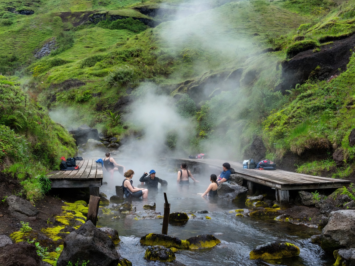
Geomorphology of the Smoky Valley
Reykjadalur (translated literally from Icelandic as "Steam Valley") is an active geothermal valley situated within the Hengill volcanic mountain system, roughly 45 kilometers southeast of Reykjavík near the greenhouse town of Hveragerði. The Hengill system is one of Iceland's most productive energy zones, powering both the Hellisheiði and Nesjavellir geothermal power stations.
Unlike commercial lagoons built with concrete barriers, piped water, and ticket turnstiles, Reykjadalur is a living mountain watercourse. Deep underground, superheated steam vents and boiling mineral springs emerge directly into the riverbed. As these scalding springs join cold meltwater flowing from higher snowfields, the waters mix naturally, creating an open-air thermal stream that is comfortable for bathing along a 200-meter stretch of the valley floor.
Thermodynamic Mixing Gradient: Choosing Your Spot
Because the thermal stream is fed continuously by hot springs upstream, the river water does not have a single fixed temperature. Instead, it forms a natural heat gradient along its course:
- Upstream Sections (Closest to Source): Temperatures regularly exceed 42°C to 45°C. Water here can be uncomfortably or dangerously hot and should be tested carefully before stepping in.
- Middle Boardwalk Zone: The sweet spot for most bathers, where cold and hot flows mix evenly to create a comfortable 37°C to 40°C temperature.
- Downstream Sections: As the river flows away from the thermal springs and meets smaller cold tributaries, temperatures drop to a milder 32°C to 35°C.
Bathers can customize their soaking temperature simply by walking up or down the riverbed. Natural stone weirs and pebble dams built by hikers create shallow pools where you can lie back submerged in 0.3 to 0.6 meters of running water.
Leave No Trace & Safety Notice: Reykjadalur has no lifeguards, waste bins, or indoor facilities along the river. All trash must be packed out, and bathers must stay strictly on the wooden boardwalks. Venturing off marked trails onto delicate moss-covered soils can cause severe foot-puncture burns from hidden boiling mud vents.
Comparative Evaluation: Wild River vs. Developed Spas
Before hiking into the valley, visitors should carefully consider whether an exposed mountain stream matches their travel preferences:
Key Merits
- Completely Free Access: There is no admission fee to bathe in the river; visitors only pay a nominal parking fee at the trailhead lot.
- Unspoiled Alpine Surroundings: Lying submerged in warm water while watching clouds drift across green volcanic mountain peaks is a truly natural Icelandic experience.
- Rewarding Hiking Combination: The 3.5-kilometer outbound hike makes the warm soak feel earned, blending physical mountain exertion with thermal relaxation.
Documented Trade-Offs
- No Indoor Changing Rooms: The site only provides simple, open-air wooden privacy screens along the boardwalk. Changing into swimwear means braving chilly winds and rain.
- Trail Elevation & Weather Hazards: The trail climbs approximately 240 meters over gravel ridges, canyon ledges, and exposed mountain slopes. It requires proper hiking boots and can become slick during rain or icy winter freezes.
- Shallow Water Depths: The river is relatively shallow, with water levels rarely exceeding waist depth. Bathers must recline horizontally against smooth river stones to keep their shoulders warm.
Trail Specifications & Preparation Checklist
Important details for planning your hike into the thermal river valley:
| Trail Metric | Measurement & Condition | Practical Advisory |
|---|---|---|
| Trail Distance | 3.5 km each way (7.0 km total) | Allow 50–70 minutes each way depending on pace |
| Elevation Gain | ~240 meters | Initial climb is moderately steep over gravel trails |
| River Water Depth | 0.3 – 0.6 meters | Build small stone dams to raise water depth if needed |
| Changing Facilities | Open-partition timber screens only | Bring a large microfibre poncho or dark towel for privacy |
| Winter Season Trail | Hard-packed snow and hidden black ice | Micro-spikes (crampons) are mandatory Nov–April |
Field Preparation and Cold-Weather Strategy
Preparation makes the difference between an exhilarating wilderness soak and an uncomfortably cold ordeal. Wear sturdy, waterproof hiking boots with grippy lug soles. The initial ascent from the Hveragerði trailhead climbs through Djúpagil canyon, past the striking Djúpagilsfoss waterfall, where gravel slopes can be slippery when wet.
Pack a dry bag containing your swimsuit, an extra set of warm wool socks, a windproof and rainproof jacket, a headlamp if hiking in the afternoon, and a quick-drying camp towel. A thermal thermos of hot tea or cocoa helps restore core body heat once you step out of the river back into brisk mountain air.